
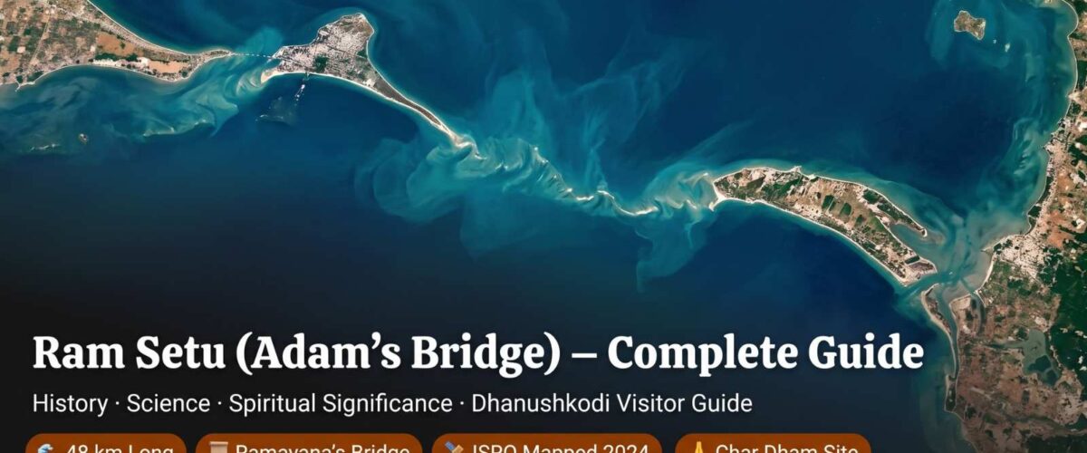
Ram Setu (Adam’s Bridge) – Complete Guide to History, Science & Spiritual Significance: The Sacred Bridge of Lord Rama
Written by Devendra Khambalkar
Nagpur, Maharashtra — temple traveller, Rameswaram pilgrim, and Hindu heritage writer
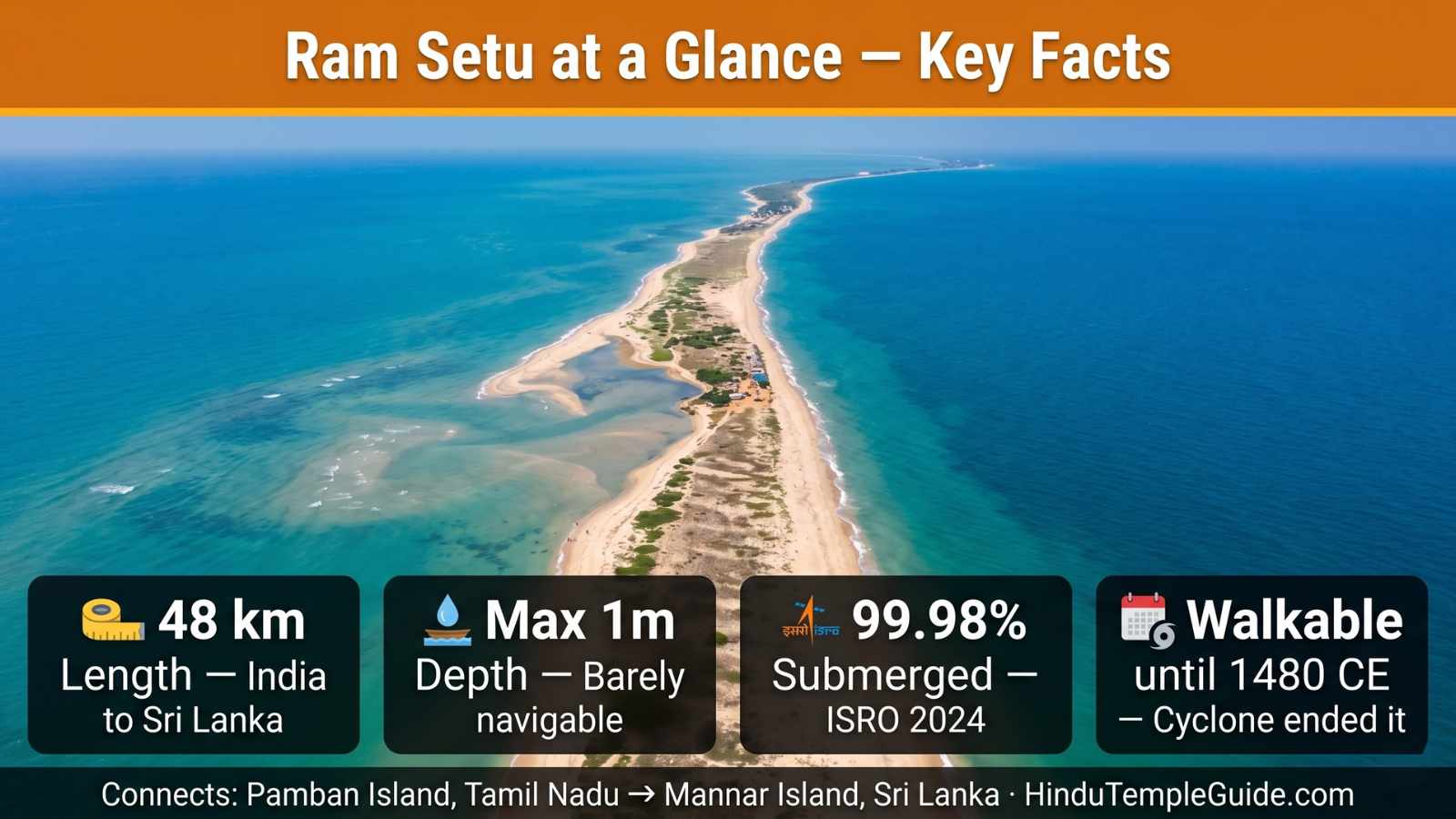
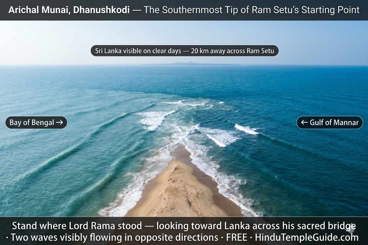
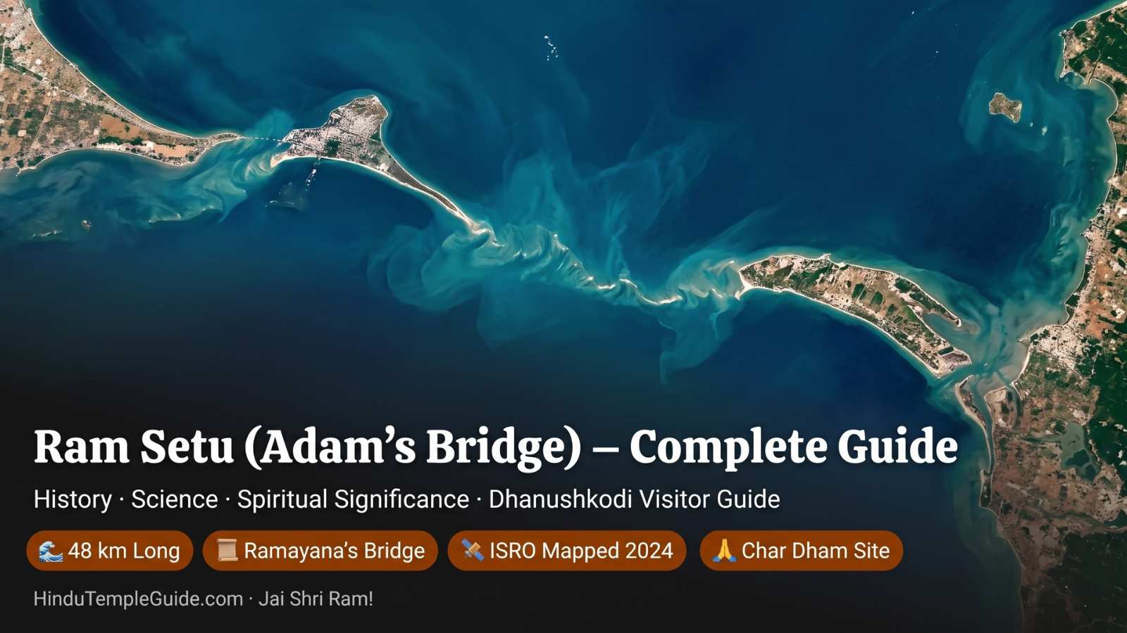
I have visited Rameswaram and stood at Arichal Munai — the southern tip of Dhanushkodi — where the Bay of Bengal and the Gulf of Mannar visibly meet, and Sri Lanka sits on the horizon just 20 km away. That experience is what made me want to write this guide properly. Ram Setu is one of the most extraordinary and most debated structures in human history — simultaneously a geological wonder, a Ramayana sacred site, an international boundary, a contested scientific mystery, and a symbol of faith for over a billion Hindus worldwide. Known in the West as Adam’s Bridge, this 48-kilometre chain of limestone shoals and sandbanks stretches across the shallow waters between Pamban Island in Tamil Nadu and Mannar Island in Sri Lanka. The sea here rarely exceeds 1 metre in depth, and until 1480 CE this remarkable bridge was reportedly passable on foot between India and Sri Lanka.
For devout Hindus, Ram Setu is not primarily a geological formation — it is the physical evidence of the Ramayana. According to Valmiki’s Ramayana, Lord Rama directed his devoted architect Nala and the great Vanara army to build this bridge to rescue Sita from demon king Ravana. This complete guide covers every dimension — the Ramayana narrative, geology, ISRO-NASA 2024 mapping, scientific debates, spiritual pilgrimage experience, and how to see Ram Setu in 2026. Jai Shri Ram!
Ram Setu is mentioned in Valmiki’s Ramayana (verse 2-22-76) as ‘Setubandhanam’ — the construction of a bridge. The sea separating India and Sri Lanka was named ‘Sethusamudram’ (Sea of the Bridge) in ancient times. The 9th-century Persian geographer Ibn Khordadbeh referred to it as ‘Set Bandhai’ (Bridge of the Sea) — confirming it was known and named as a bridge centuries before the colonial renaming to ‘Adam’s Bridge.’
Quick Navigation
Table of Contents
Ram Setu Quick Facts 2026
| Detail | Facts |
|---|---|
| Other Names | Adam’s Bridge · Rama Setu · Setubandha · Nala Setu · Set Bandhai |
| Length | 48 km (30 miles) end to end |
| Location | Between Pamban Island (India) and Mannar Island (Sri Lanka) |
| Depth | Rarely exceeds 1 metre — very shallow waters |
| Separates | Gulf of Mannar (southwest) from Palk Strait (northeast) |
| Geological Class | Natural tombolo — chain of limestone shoals and sandbanks |
| % Submerged | 99.98% submerged (ISRO-NASA ICESat-2 mapping 2024) |
| Historical Walkers | Reportedly walkable until 1480 CE · Cyclone submerged the route |
| Ramayana Name | Setubandhanam (Valmiki Ramayana verse 2-22-76) |
| Builder in Ramayana | Nala (divine architect, son of Vishwakarma) with Vanara army |
| Best View Point | Arichal Munai (tip of Dhanushkodi) — 20 km from Rameswaram · FREE |
The Ramayana Story — How Lord Rama Built Ram Setu
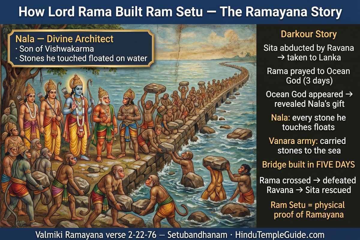
The story of Ram Setu in the Ramayana is one of the most powerful narratives of divine determination, devotion, and engineering genius in all of Hindu scripture. After Sita was abducted by demon king Ravana and taken to Lanka, Rama faced what seemed an impossible challenge. Rama sat on the southern shore in deep meditation — beseeching the Ocean God (Samudra Devata) to part the waters. After three days of prayer and no response, the righteous Rama threatened to dry up the ocean with his divine bow — and at that point, the Ocean God appeared and revealed the solution.
The Ocean God told Rama: “In your army is Nala, son of divine architect Vishwakarma, and he has inherited his father’s genius. Whatever stone he touches will float on water. Let Nala build the bridge.” Under Nala’s architectural direction, the entire Vanara army worked together. The boulders floated upon touching the water. The bridge was completed in just five days. Rama’s army crossed over, Ravana was defeated, Sita was rescued — and Ram Setu became the physical symbol of Rama’s divine determination and the Vanara army’s unconditional devotion. Jai Shri Ram!
Ram Setu in History — Ancient Records & Medieval References
The Ram Setu appears not just in the Ramayana but in a remarkable array of historical, geographic, and religious texts spanning nearly two millennia:
| Source & Date | Reference to Ram Setu / Adam’s Bridge |
|---|---|
| Valmiki Ramayana (8th–3rd c. BCE) | ‘Setubandhanam’ — bridge construction described in detail across multiple chapters |
| Mahabharata | References to the Setubandha (bridge construction) as a historical event |
| Ibn Khordadbeh (c. 850 CE) | 9th-century Persian geographer refers to it as ‘Set Bandhai’ (Bridge of the Sea) |
| Al-Biruni (c. 1030 CE) | First appearance of ‘Adam’s Bridge’ name — based on Islamic tradition of Adam crossing to India |
| Marco Polo (13th c.) | Mentions the shallow waters and the structure in his travel accounts |
| Ramanathaswamy Temple records | Record the bridge was above sea level until 1480 CE when a cyclone submerged it |
| Dutch cartographer (1747 CE) | Map shows the area as ‘Ramancoil’ (Raman Kovil — Rama’s Temple) — confirming Hindu identity |
| Sir Arthur Cotton (1823 CE) | British survey of Pamban Channel — first systematic modern survey of Ram Setu |
| Edgar Thurston (1914) | Describes the structure as ‘remains of a formerly elevated limestone flat’ |
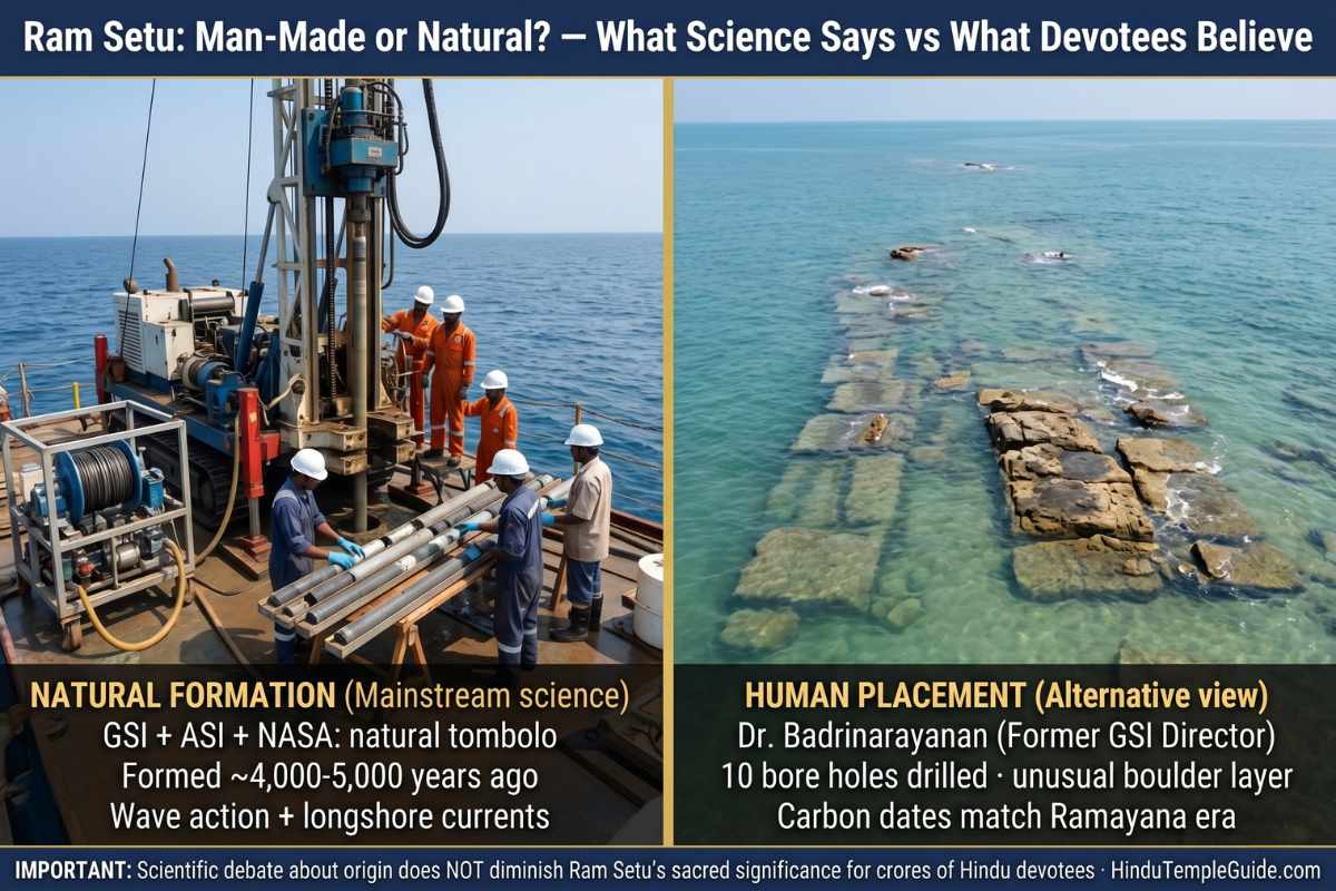
The Science of Ram Setu — Geology, ISRO Mapping & Carbon Dating
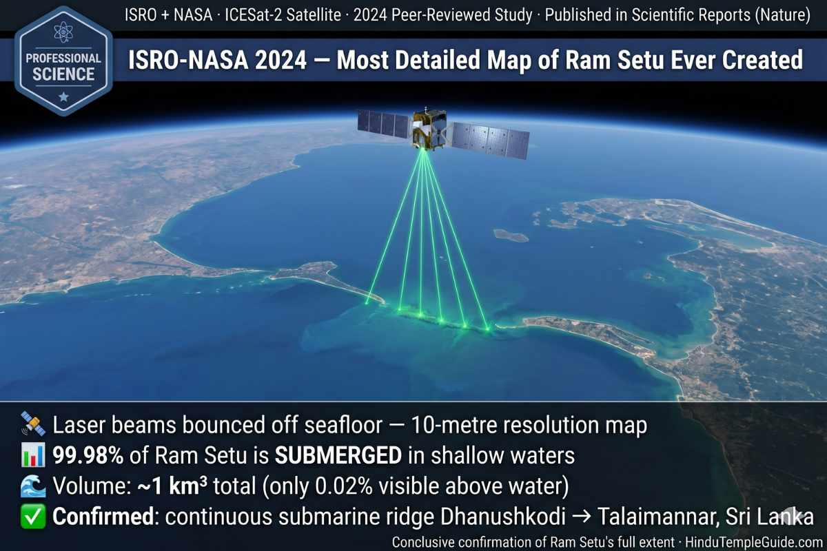
ISRO-NASA 2024 Mapping — Key Findings
| Scientific Question | Mainstream Scientific Answer |
|---|---|
| What is Ram Setu? | Natural tombolo — chain of limestone shoals formed by wave action, longshore currents and sand deposition |
| How old are the sandbanks? | ~4,000–5,000 years old (carbon dating of beaches) — formed during post-glacial sea level changes |
| Were India and Sri Lanka connected? | Yes — during the Last Glacial Period (115,000–11,700 years ago), the Palk Strait was dry land |
| What are the rocks made of? | Limestone, sandstone, coral, and calcareous sandstone layers |
| Was it walkable? | Historical records state walkable until a 1480 CE cyclone broke the link |
| Carbon dating matches Ramayana? | Beach carbon dating (~4,000 years) roughly matches some Ramayana date estimates — researcher S.M. Ramasamy (2003): “Its linkage with Ramayana needs to be explored” |
Ram Setu Man-Made or Natural? — The Great Scientific Debate
The Floating Stones of Rameswaram — Where Science Meets Faith
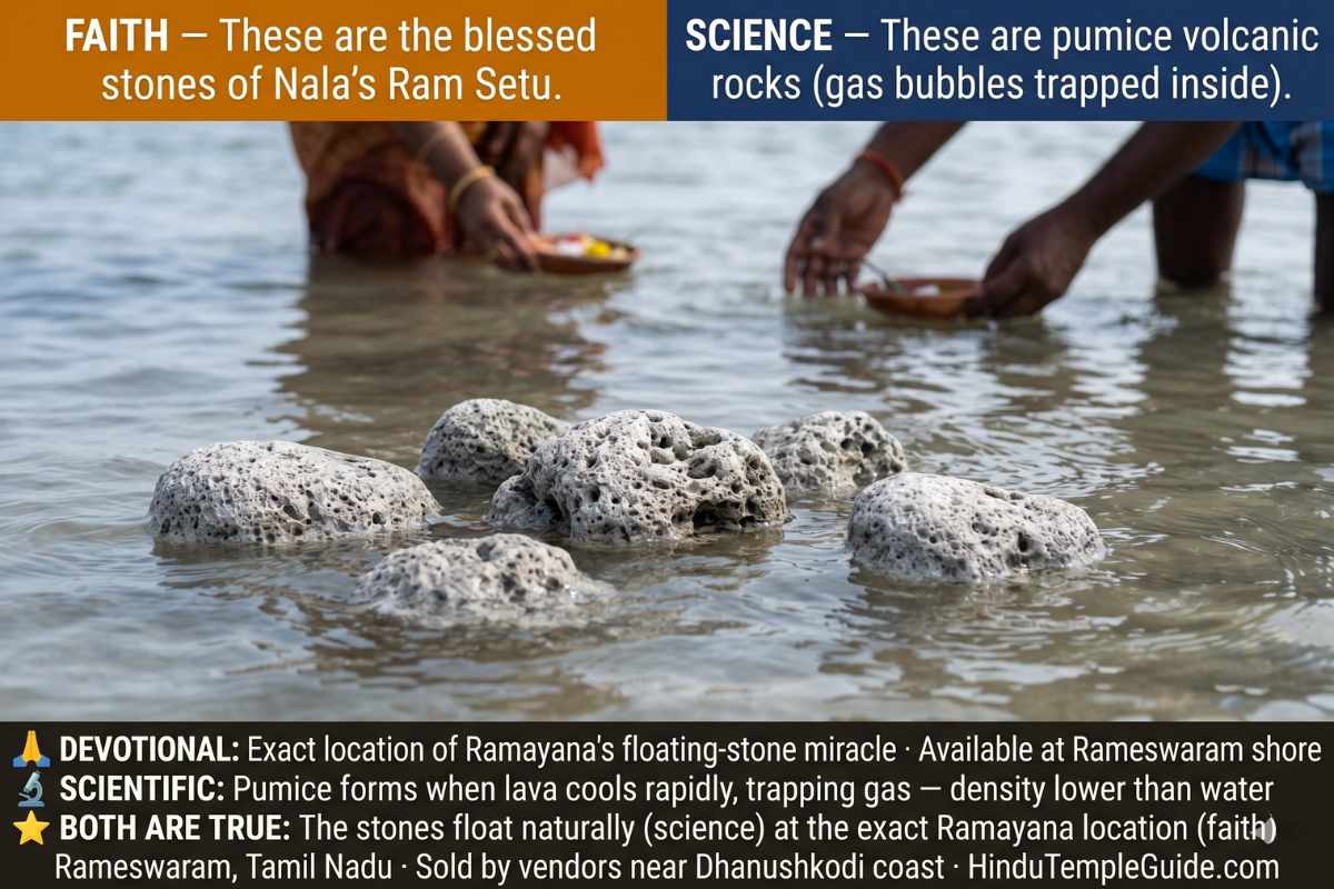
For a devotee, the question of why the stones float is less important than the fact that they float — here, at this exact location described in the Ramayana. This is the beautiful convergence of faith and observation that makes Ram Setu one of the most fascinating sacred sites in the world.
Spiritual Significance of Ram Setu — Why It Is Sacred
When I stood at Arichal Munai with the two seas meeting at my feet and Sri Lanka visible on the horizon, I understood in a way no book had explained why this place matters so deeply to so many people. Ram Setu is not an abstract theological concept. It is the physical address of the Ramayana’s most pivotal moment — where Lord Rama’s faith, Hanuman’s devotion, Nala’s genius, and the Vanara army’s selfless labour all converged to achieve the impossible.
The Sethusamudram Shipping Canal Controversy
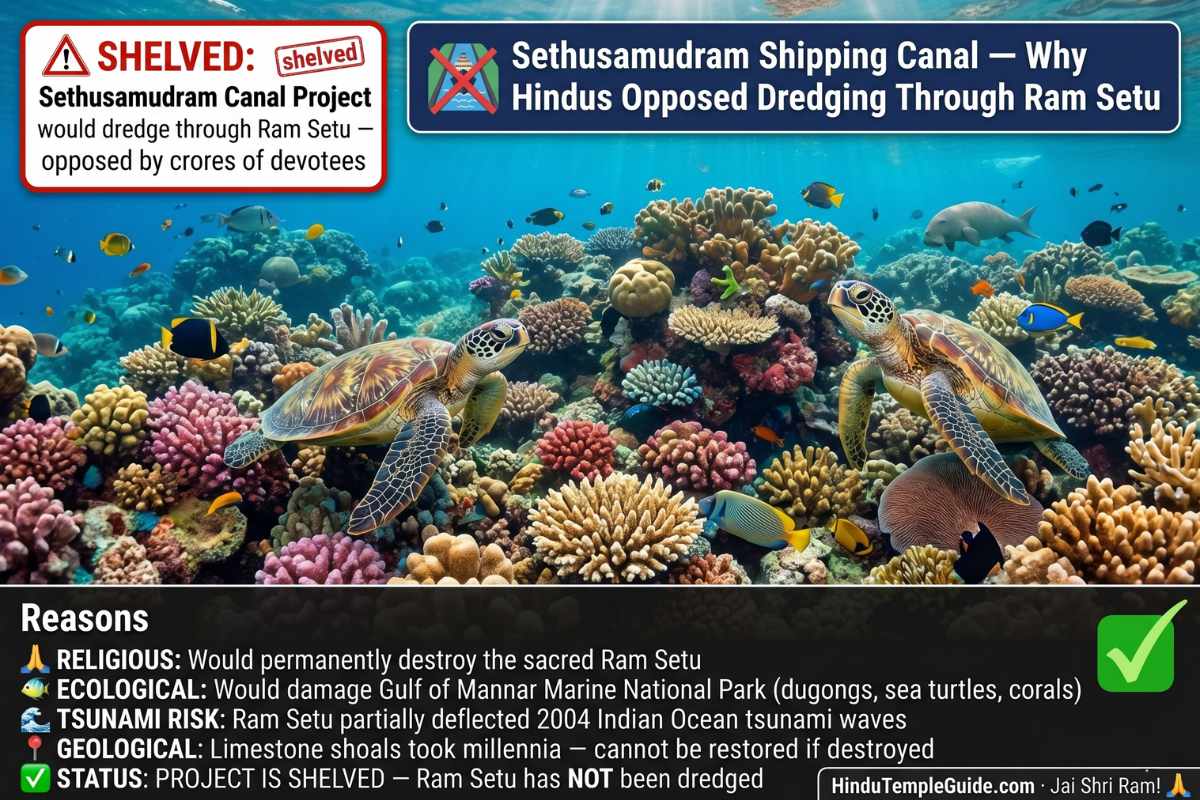
The most politically charged episode in Ram Setu’s modern history was the Sethusamudram Shipping Canal Project (SSCP) — a proposed canal requiring dredging through the limestone shoals of Ram Setu. When the UPA government approved it in 2005, it triggered one of India’s largest religious protest movements — crores of Hindus marching across India opposing the destruction of Ram Setu.
How to See Ram Setu 2026 — Complete Visitor & Pilgrimage Guide
Ram Setu Pilgrimage Circuit — What to Visit
| Sacred Site | Significance & Details |
|---|---|
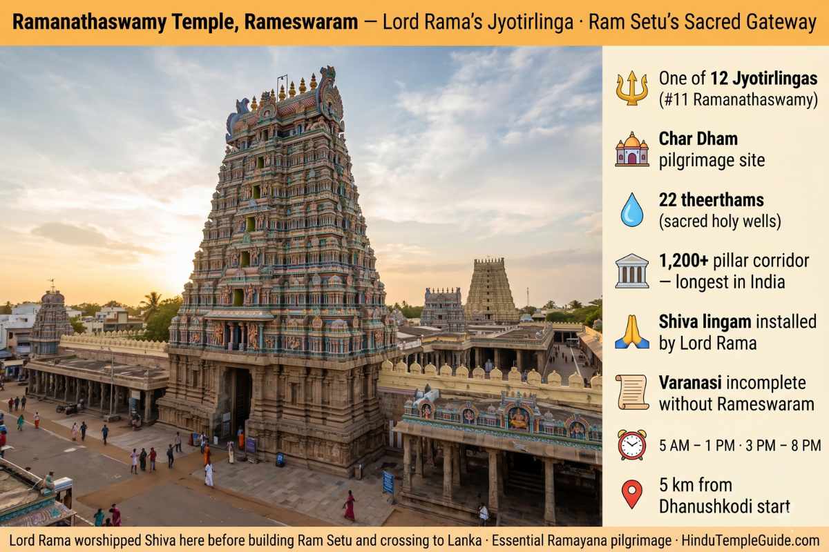
| Ramanathaswamy Temple | One of 12 Jyotirlingas + Char Dham · 22 theerthams · 1,200+ pillar corridor (longest in India) |
| Agni Theertham Beach | Sacred bathing point · Ritual bath before Ramanathaswamy darshan |
| Sethu Karai | 22 km before Rameswaram · Traditional launch point of Ram Setu |
| Pamban Bridge | India’s first sea bridge (1914) · Gateway to Rameswaram · Spectacular sea views |
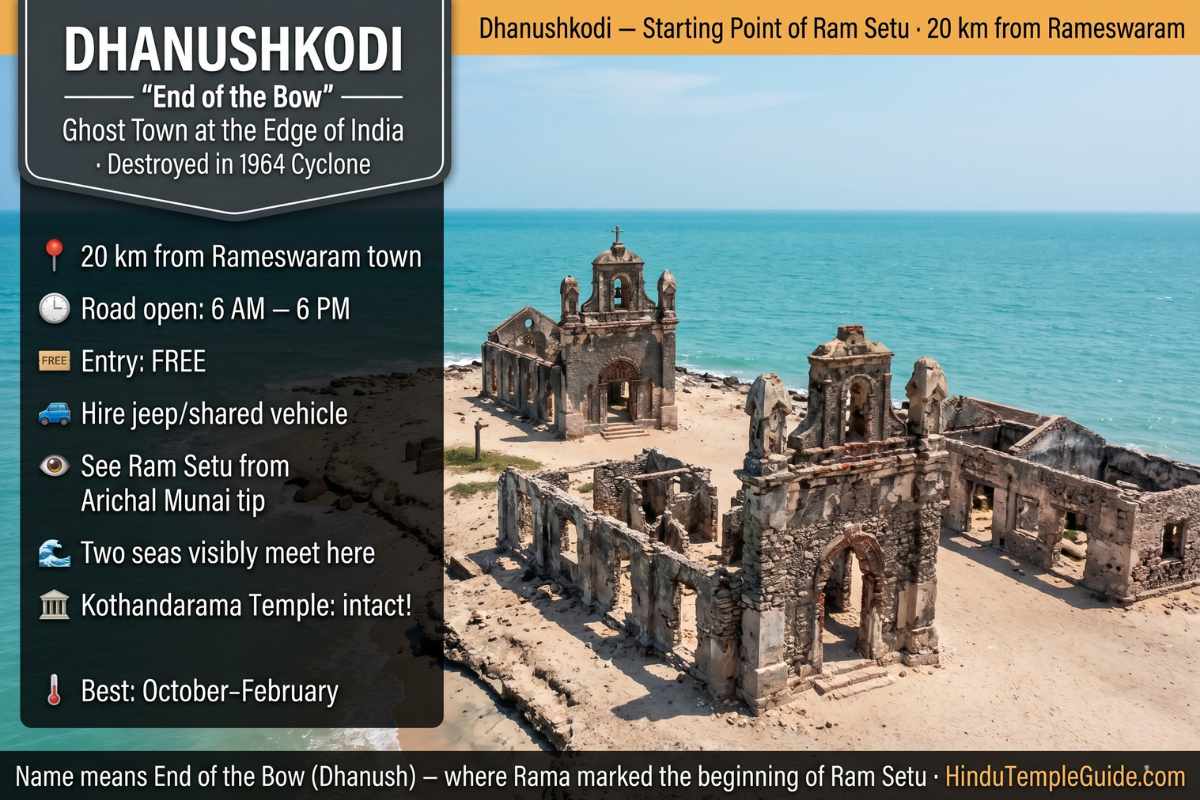
| Dhanushkodi Village | 20 km from Rameswaram · Ghost town of 1964 cyclone · Ruins of railway station, church, hospital |
| Arichal Munai | Tip of Dhanushkodi · Two seas meet · Can spot Sri Lanka · Start of Ram Setu |
| Kothandarama Swamy Temple | 18 km from Rameswaram · Site where Vibhishana surrendered to Lord Rama · Survived 1964 cyclone intact |
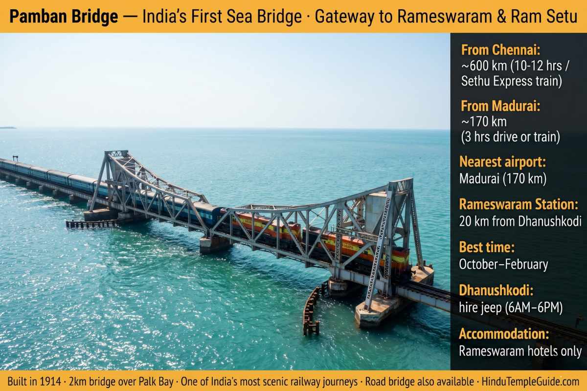
Practical Visitor Information 2026
| Best Time to Visit | October–February · Pleasant weather 20–30°C · Cool sea breeze |
| Road to Dhanushkodi | Hire jeep from Rameswaram · Beach road open 6 AM–6 PM only |
| Entry Fee | FREE — no entry fee |
| Nearest Airport | Madurai Airport (170 km) |
| Nearest Railway | Rameswaram Railway Station · Sethu Express from Chennai direct overnight |
| Accommodation | In Rameswaram only — range of hotels near Ramanathaswamy Temple |
| From Chennai | ~600 km by road (10–12 hrs) · Sethu Express overnight train |
| From Madurai | ~170 km by road (3 hrs) · Best base for Rameswaram trip |
FAQs — Ram Setu 2026
Char Dham Yatra 2026 Complete Guide – Including Rameswaram Circuit
12 Jyotirlinga in India 2026 – Ramanathaswamy at Rameswaram is #11
Sapta Puri Complete Guide – 7 Holiest Hindu Cities (Includes Rameswaram)
Temples in Tamil Nadu 2026 – Top 15 Temples Including Rameswaram
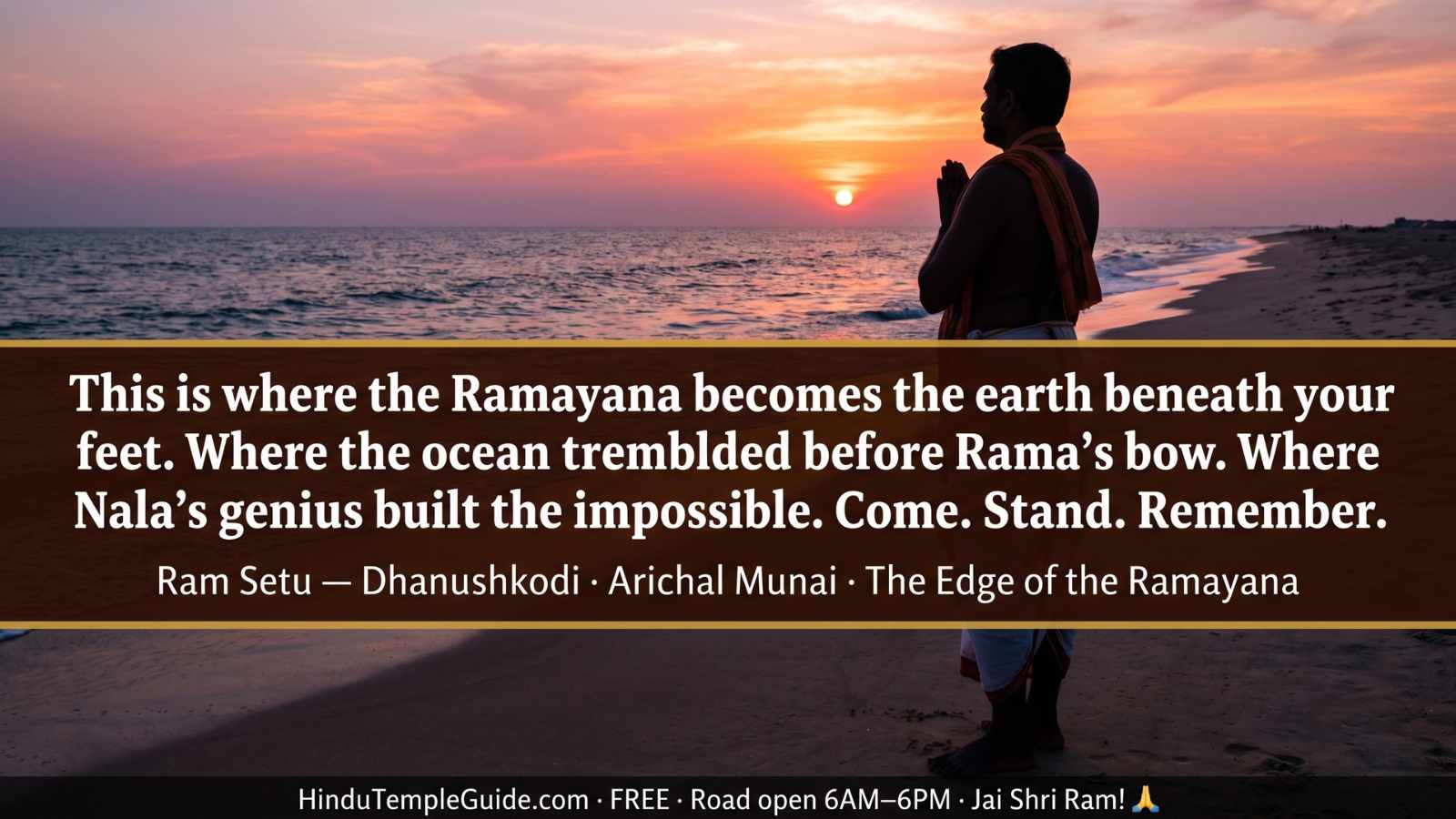
Stand at the Edge of the Ramayana || Jai Shri Ram!
Plan your Rameswaram and Dhanushkodi pilgrimage. Take the holy bath at Agni Theertham. Receive darshan at Ramanathaswamy Jyotirlinga. Stand at Arichal Munai and look toward Lanka. Ram Setu will leave something in you that no other place in India quite replicates.
Questions about the Rameswaram pilgrimage? Write to me directly — I read every message personally.
— Devendra Khambalkar, Nagpur, Maharashtra
Written by Devendra Khambalkar, Nagpur, Maharashtra | Last updated: April 2026. This guide presents both the spiritual-devotional perspective of Ram Setu as described in the Valmiki Ramayana and the scientific findings of ISRO, GSI, ASI, and NASA with equal respect. The debate about Ram Setu’s natural or human origins remains open. HinduTempleGuide.com respects both the faith of crores of Hindu devotees and the integrity of scientific research. Jai Shri Ram!
You May Also Like


Leave a Comment
Your email will not be published. Required fields are marked *